Novustech.

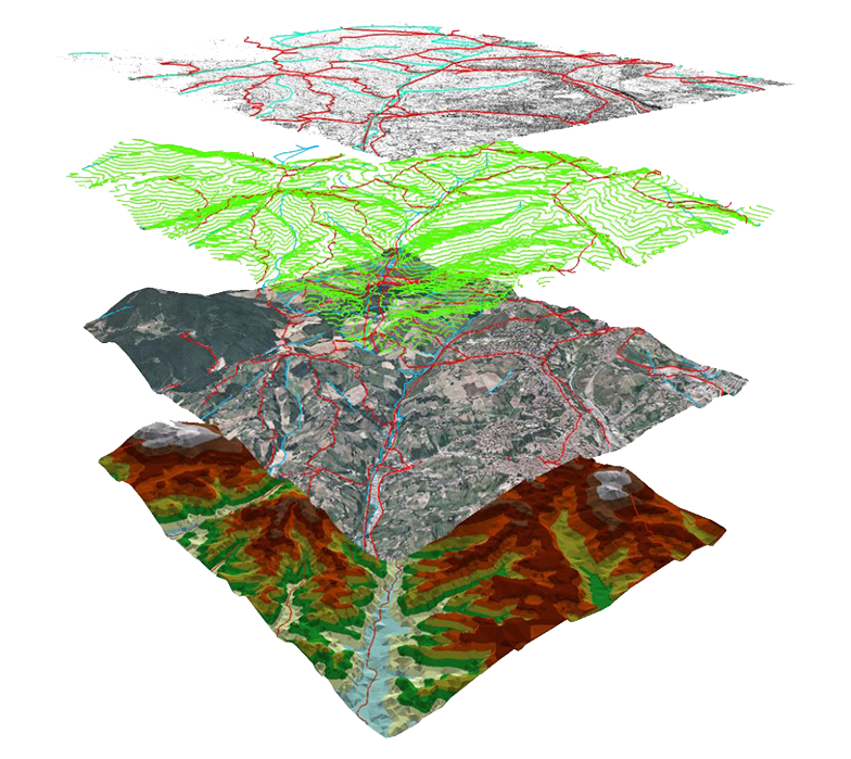
Unlock the fastest method of survey and elevate your worksite productivity with the most futuristic solution to all your problems.

  • We capture topographic data with drones i.e, up to five times faster than with land-based methods which requires more manpower. Time is also saves, as placing numerous GCPs is no longer necessary. Ultimately the survey results are delivered faster and at a lower cost.
  • One drone flight produces thousands of measurements, which can be represented in different formats (orthomosaic, point cloud, DTM, DSM, contour lines, etc). Each pixel of the produced map or point of the 3D model contains 3D geo-data.
  • An aerial mapping drone can take off and fly almost anywhere. You are no longer limited by unreachable areas, unsafe steep slopes or harsh terrain unsuitable for traditional measuring tools. You do not need to close down highways or train tracks. In fact, you can capture data during operation without an organizational overhead.

More About Our Work

Get a quick and accurate survey with Novustech. Look into our services to book now!

"1800+

Acres of Area Covered

"90+

Hours of Flying

"24/7

Services Available

Our Happy Clients

    Get in Touch for more information